


How to Navigate Arad City Center: A Traveler’s Guide
- Arad Zone
- 5 days ago
- 9 min read

Getting around Arad can feel overwhelming for first-time visitors, especially with streets named after historical figures and signs primarily in Romanian. Yet over 80 percent of the city’s top attractions are packed within a walkable downtown area, which sounds almost too easy for travelers who expect a complicated maze. The real challenge is not how to move around, but how to soak in all the hidden stories and multicultural landmarks woven into every turn of this compact city.
Table of Contents
Quick Summary
Key Point | Explanation |
1. Research Arad’s layout thoroughly | Use digital maps to familiarize yourself with key landmarks and routes. |
2. Download offline navigation apps | Install apps for offline maps and local transit for seamless exploration. |
3. Utilize public transportation wisely | Understand ticket systems and primary routes for efficient travel. |
4. Learn local navigation signs | Recognize visual cues and common Romanian terms to enhance navigation. |
5. Explore attractions strategically | Prioritize sightseeing based on proximity and historical significance. |
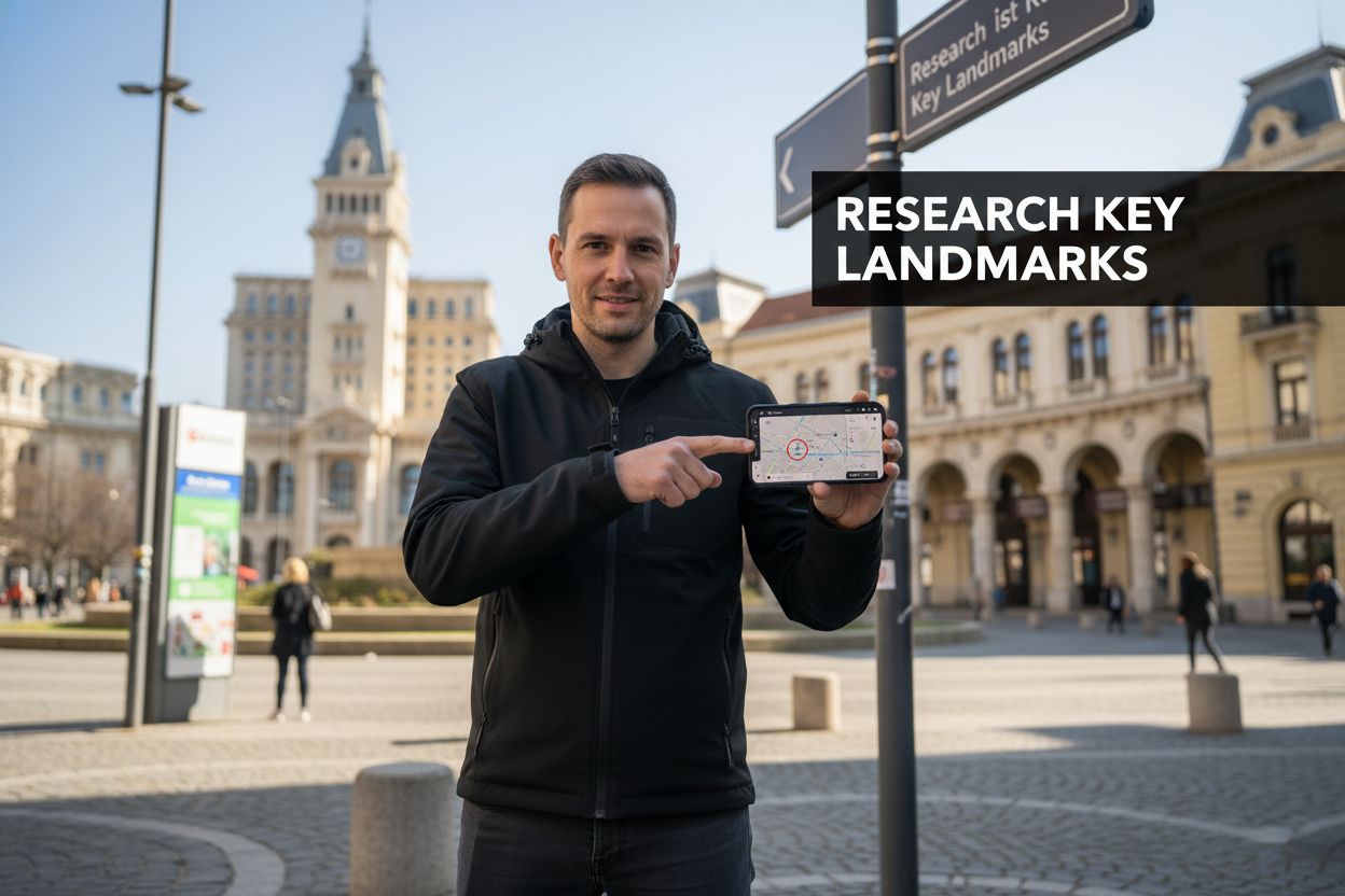
Step 1: Research Arad’s Layout and Key Landmarks
Preparing for your journey through Arad requires strategic planning and understanding the city’s unique geographical and cultural landscape. Your first step involves comprehensive research that will transform an unfamiliar urban environment into a navigable and exciting destination.
Understanding Arad’s Urban Structure
Arad sits elegantly along the Mureș River, presenting travelers with a fascinating blend of historical architecture and modern urban design. Britannica’s regional overview highlights the city’s neoclassical and Secession-style architectural heritage, which serves as an essential framework for your exploration. The city center represents a compact, walkable area where most significant landmarks are concentrated within reasonable walking distances.
To effectively research Arad’s layout, start by acquiring a detailed digital or physical map. Google Maps and local tourism websites offer excellent resources for understanding street configurations and landmark locations. Pay special attention to key areas like Avram Iancu Square and the City Hall, which serve as central reference points for navigation. These landmarks are not just historical sites but practical orientation tools that will help you understand the city’s spatial organization.
Digital and Physical Research Tools
Your research toolkit should include multiple complementary resources:
Official city tourism websites
Digital mapping applications
Local travel blogs focusing on Arad
Physical maps from tourist information centers
Downloadable city guide applications
By combining these resources, you’ll develop a comprehensive understanding of Arad’s urban landscape. Focus on identifying walking routes, public transportation lines, and the spatial relationships between major attractions. This preparation eliminates potential confusion and helps you move confidently through the city’s streets.
Remember that effective research is about building a mental map that goes beyond mere geographical details. You’re not just memorizing streets but understanding the city’s rhythm, architectural character, and cultural significance. Each landmark tells a story, and your preliminary research will help you appreciate these narratives before you even set foot in Arad.
Step 2: Download Essential Navigation Apps
In the digital age, smart navigation begins with selecting the right mobile applications that transform your smartphone into a powerful travel companion. This critical step will equip you with technological tools designed to simplify your exploration of Arad’s intricate urban landscape.
Choosing the right navigation apps requires a strategic approach that balances functionality, offline capabilities, and local precision. Google Maps provides comprehensive navigation solutions specifically tailored for travelers navigating unfamiliar cities like Arad. Prioritize apps that offer downloadable offline maps, which become invaluable when cellular data is limited or expensive.
Start by ensuring your smartphone has sufficient storage space and a stable internet connection for downloading. The primary apps you’ll want to install include multilingual navigation tools that work effectively in Romania. Google Maps stands out as a universal option, providing detailed street views, real-time public transportation information, and precise walking routes. For travelers seeking more comprehensive travel assistance, apps like Maps.me and OpenStreetMap offer additional layers of local information and offline functionality.
Beyond standard navigation, consider supplementing your digital toolkit with location-specific applications.
The following table compares popular navigation and travel apps mentioned in the article, summarizing their primary features and unique advantages for exploring Arad.
App Name | Key Features | Best For |
Google Maps | Offline maps, real-time transit, street view | Comprehensive city navigation |
Full offline capability, walking routes | Reliable navigation without internet | |
OpenStreetMap | Open-source, detailed local info | Detailed alternative mapping |
Local Transit | Bus and tram schedules, local routes | Real-time transit planning |
Language Apps | Romanian translation | Communication with locals |
Local transit apps for Arad can provide real-time bus and tram schedules, helping you navigate the city’s public transportation network with confidence. Romanian language translation apps can also prove crucial when interacting with local transportation services or asking for directions. |
Verify your app setup through a simple checklist:
Below is a checklist table that summarizes the essential steps to set up your navigation apps before exploring Arad, providing a quick reference to ensure you’re ready for offline and on-the-go travel.
Task | Details | Status Check |
Download offline maps | Ensure maps of Arad are available offline | Maps open and display city layout |
Confirm GPS functionality | Test location accuracy without mobile data | Location marker appears correctly |
Install language translation tool | Choose app tailored for Romanian | Basic phrases tested |
Test route calculation | Plan routes to various city areas | Navigation works in all zones |
Downloaded offline maps of Arad
Confirmed GPS functionality without cellular data
Installed local language translation tool
Tested route calculation in different city areas
By meticulously preparing your digital navigation resources, you transform potential travel uncertainty into a seamless, confident exploration of Arad. These apps become more than mere tools they’re your personal guides through the city’s vibrant streets and hidden corners.
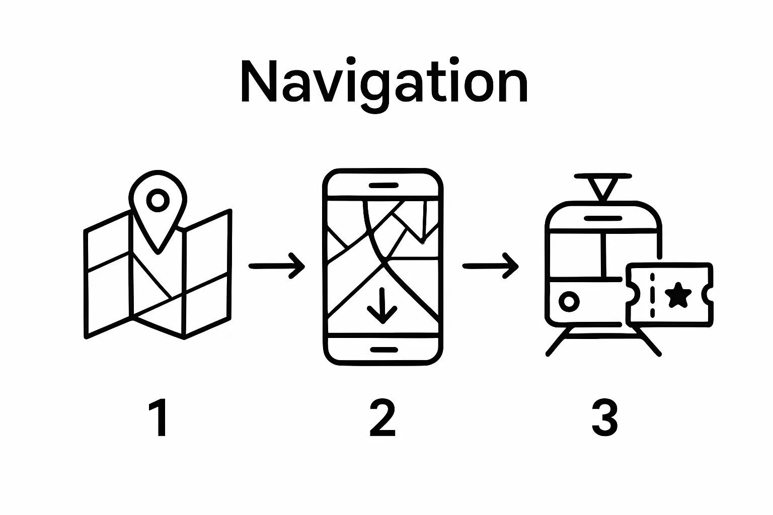
Step 3: Plan Your Route Using Local Transport Options
Effective navigation through Arad requires understanding and mastering the city’s public transportation system. Your ability to move efficiently will transform your travel experience from potentially frustrating to remarkably smooth and enjoyable.
Local transportation in Arad primarily consists of an integrated network of buses and trams that connect the city’s major districts and landmarks. Romania’s tourism resources highlight the comprehensive urban transit system that makes exploring the city both convenient and affordable. Begin by obtaining a comprehensive transit map, either digitally through your previously downloaded navigation apps or physically from the local tourist information center.
Purchasing the right transportation ticket is crucial for seamless movement. Most cities in Romania offer daily, multi-day, and weekly transit passes that provide unlimited rides across different transportation modes. Look for integrated ticket systems that allow transfers between buses and trams within a specific time frame. These passes not only save money but eliminate the need to purchase individual tickets for each journey.
To maximize your transportation efficiency, identify the primary routes connecting key attractions. Bulevardul Revolutiei serves as a central artery where multiple transit lines intersect, making it an ideal reference point for planning your daily movements. Pay attention to route numbers, frequency of service, and peak hours when public transportation tends to be more crowded.
Your transit planning checklist should include:
Locate nearest bus and tram stops to your accommodation
Understand ticket purchasing methods (mobile app, kiosk, onboard)
Note peak travel times to avoid overcrowding
Identify backup transportation alternatives
Remember that local transportation is more than a mere logistical consideration it’s an opportunity to experience the city like a resident. Observing local commuters, understanding the rhythm of urban movement, and navigating public spaces will provide insights into Arad’s daily life that go far beyond typical tourist experiences. Your strategic approach to local transit will unlock a more authentic and immersive travel adventure.

Step 4: Familiarize Yourself with the City’s Navigation Signs
Navigating an unfamiliar city requires more than digital maps and transportation schedules it demands an understanding of the local visual language of street signs, directional markers, and urban signage. Arad’s navigation system blends historical architectural cues with modern informational design, creating a unique wayfinding environment that travelers must learn to interpret.
Street signs in Arad are typically displayed in Romanian, with key landmarks and directional information presented in both Romanian and sometimes English. Pay close attention to street names, which often honor historical figures or significant cultural moments. Intersections typically feature comprehensive signage indicating multiple directions, allowing you to cross-reference your digital maps with physical landmarks.
The city center presents a particularly rich navigation landscape where architectural landmarks serve as natural orientation points. Blue historical markers provide context about significant buildings, while modern informational signs guide tourists toward museums, public spaces, and transportation hubs. Learn to recognize official municipal signs with their distinctive blue and white color scheme, which typically indicate official tourist information, street names, and directional guidance.
To effectively decode Arad’s navigation signs, develop a systematic approach that combines visual observation with your digital navigation tools.
Here is a quick-reference table to help you recognize and interpret common navigation terms and signs found around Arad, allowing you to move confidently throughout the city.
Romanian Term | English Translation | Where to Find It | Significance |
Centru | City center | Directional signs, maps | Guides toward central attractions |
Iesire | Exit | Public buildings, transport | Indicates exits from locations |
Intrare | Entrance | Museums, attractions | Marks entry points |
Informatii | Information | Tourist info points, signs | Provides tourist and local information |
Parcare | Parking | Streets, garages | Indicates parking locations |
Start by understanding common Romanian directional terms: |
“Centru” means city center
“Iesire” indicates exit
“Intrare” means entrance
“Informatii” signifies information
“Parcare” refers to parking areas
Beyond linguistic preparation, train your eyes to recognize architectural and spatial cues. The relationship between street signs, building facades, and urban layout in Arad tells a complex story of multicultural heritage. Each sign becomes more than a mere directional tool it is a fragment of the city’s historical narrative waiting to be understood.
Your ability to read and interpret these signs transforms you from a passive tourist to an active urban explorer. By developing this skill, you gain not just navigational confidence but a deeper appreciation for Arad’s intricate urban design and cultural complexity.
Step 5: Explore Major Attractions and Points of Interest
Exploring Arad’s major attractions requires a strategic approach that balances cultural immersion with efficient navigation. Your journey through the city’s landmarks will reveal a rich tapestry of historical and architectural treasures that reflect its multicultural heritage.
The city center serves as your primary exploration hub, where most significant attractions are concentrated within walking distance. UNESCO heritage resources highlight Arad’s architectural significance in the broader context of Romanian cultural landscapes. Begin your exploration at Avram Iancu Square, the heart of the city, where neoclassical buildings and historical monuments provide an immediate visual narrative of Arad’s complex history.
Prioritize your attractions based on geographical proximity and historical significance. The Arad Fortress, a massive star-shaped defensive structure, represents a must-visit landmark that offers insights into the region’s military history. Nearby, the Administrative Palace and the Orthodox Cathedral showcase stunning architectural details that speak to the city’s diverse cultural influences. Plan your route to minimize unnecessary walking and maximize your time exploring each location’s unique characteristics.
To optimize your attraction exploration, consider these strategic considerations:
Purchase a combined ticket for multiple attractions when possible
Verify operating hours before visiting each location
Carry water and comfortable walking shoes
Allow flexible time between attractions for unexpected discoveries
Timing is crucial when exploring city attractions. Morning hours typically offer fewer crowds and better lighting for photography, while late afternoon provides softer natural illumination that highlights architectural details. Some museums and historical sites might have reduced hours or specific entry requirements, so always check local tourism websites or contact venues directly for the most current information.
Remember that exploring Arad’s attractions is more than a checklist of historical sites. Each location tells a story of cultural intersection, architectural evolution, and historical transformation. Approach each attraction with curiosity, allowing yourself moments of spontaneous discovery and deeper engagement beyond typical tourist experiences.
Unlock the Secrets of Navigating Arad Like a Local
Struggling to confidently find your way through Arad’s lively city center? You are not alone. Many travelers feel overwhelmed when facing unfamiliar city layouts, complex public transport, and unfamiliar street signs. This article gave you step-by-step guidance on using digital resources, planning metro routes, and interpreting local signage, but what if you could access even deeper local insights and curated travel tools—customized for Arad’s one-of-a-kind atmosphere?
Why settle for confusion when you can explore smarter? Visit Arad.zone for exclusive guides and real-time tips about Arad’s multicultural wonders. Discover curated routes, expert walking tours, and authentic stories you will not find anywhere else. Start your journey with us and turn every walk through Arad into an unforgettable adventure. Take your travel experience to the next level today—unlock insider secrets now at Arad.zone.
Frequently Asked Questions
How can I effectively research Arad’s layout before my visit?
To effectively research Arad’s layout, utilize digital maps like Google Maps, local tourism websites, travel blogs, and physical maps obtained from tourist information centers. Focus on identifying key landmarks and walkable areas to better navigate the city.
What navigation apps should I download for my trip to Arad?
For your trip to Arad, download apps like Google Maps for comprehensive navigation, Maps.me for offline capabilities, and local transit apps for real-time updates on buses and trams. Make sure to include a language translation app to assist with communication.
What transportation options are available for getting around Arad?
Arad has an integrated network of buses and trams that connect major districts and landmarks. You can purchase daily, multi-day, or weekly transit passes for unlimited rides and easy transfers between different transportation modes.
What should I look for in Arad’s navigation signs?
When navigating Arad, look for street signs that are typically in Romanian, with some in English. Pay attention to landmark markers, directional information, and the blue and white municipal signs that guide tourists toward key attractions and public transport.
Recommended
Comments